Saturday, September 12, 2015

Spend a Week in Paradise & Take a Walk in the Clouds

Koke'e State Park, Kauai, Hawai'i (Oct 4th - Oct 10th 2015)

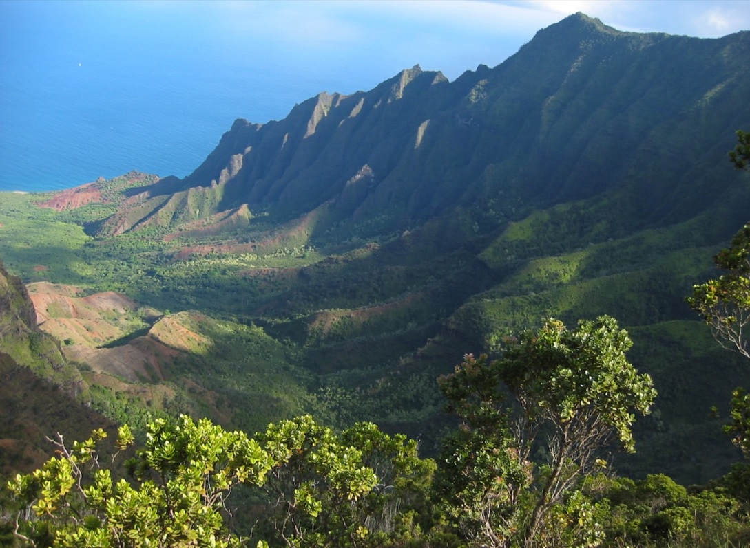
Located north of Waimea Canyon on the west side of Kauai, Koke'e State Park covers over 4000 acres of fluted cliffs, lush green tropical rainforest and cloud covered bogs at an elevation of roughly 3000 to 4000 feet above sea level.


With over 45 miles of hiking trails through cloud forests covered in mosses and ferns, Koke'e State Park is an excellent spot to see native Hawaiian plants (like koa, 'ohi'a, and mamane trees) and colorful endemic Hawaiian forest birds (like the apapane, i'iwi and 'amakihi).

Koa trees can reach heights of well over 100 feet.
I'iwi are bright orange-red and have long curved bills.
Apapane rely heavily on the nectar of 'ohia blossoms.
Beautiful 'Ohi'a trees are common in Hawai'i
Mamane trees can grow to over 50 feet and prefer higher elevations.
 'Amakihi are green-yellow Hawaiian honeycreepers.

Akala (giant Hawaiian raspberry)
Koke'e's ecologically rich high elevation forests are truly unique in the world and are in need of protection from invasive plants which threaten their existence.

On the Wilderness Volunteers Koke'e trip our service project will focus on the removal of non-native, invasive plants and vines such as Kahili ginger, Strawberry guava, Firetree, and Banana poka.

Our partner organization on this project is the Koke'e Resource Conservation Program, a volunteer based alien species control program working in cooperation with the HawaiĘ»i Department of Land & Natural Resources State Parks Division.

The Banana Poka is an aggressive woody vine that can entangle and kill large stands of forest.   
Learn more about Kauai’s native plants, flowers, trees and birds in the cloud forests of Koke'e with Wilderness Volunteers!

Read more about the area and the project here.

Tuesday, September 01, 2015

North America's Tallest Mountain Has A New (Old) Name

DENALI

This week President Obama announced that he would be issuing an executive order to change the name of North America's tallest mountain. 

In 1917 the 20,237 foot peak (called Denali by indigenous Athabascan people) was federally recognized as Mt. McKinley in honor of assassinated President McKinley. After decades of controversy over the name and repeated attempts by the state of Alaska to rename the peak against fervent opposition from Ohio (McKinley's home state) the matter was finally decided this week.  

Read more about it here.

Monday, August 03, 2015

Photos From The Field

Here are just a few of the fantastic photos uploaded to the Wilderness Volunteers Gallery so far this season.

Hammond Canyon, Manti LaSal National Forest, UT (photo by Tim P.) 

Mojave National Preserve, CA (photo by Paul G.)

Admiralty National Park, AK  (Photo by Bob. H.)
 Superstition Wilderness, AZ (Photo by Ralph K.)
Volcano National Park, HI (photo by Ashely N.)
Mojave National Preserve, CA (photo by Paul G.)
Canyon De Chelly, AZ (photo by Lisba F.) 


Admiralty National Park, AK (photo by Rose B.)

Escalante River, Glen Canyon NRA, UT (photo by Chris R.)

Siskiyou Wilderness, CA (photo by Ken W.)
Mojave National Preserve, CA (photo by Jaclyn.G.)


Siskiyou Wilderness, CA (photo by Reed M.)

Yosemite National Park, CA (photo by Dean T.)
Mojave National Preserve, CA (photo by Paul G.)
Denali National Park, AK (Photo by Katy G.)


 A huge thank you to all our volunteers for helping Wilderness Volunteers give something back in 2015!

You can see other photos from the 2015 trip season as well as pics from previous seasons at the Wilderness Volunteers Photo Gallery.

Friday, July 31, 2015

The Real Cost of Disposable Plastic Water Bottles


An average bottle of water only costs about $1.21 but what else does that bottle cost us?

Some scary facts about bottled water:
  • In 1976 the average American consumed 1.6 gallons of bottled water each year
  • In 2008 the average American consumed 28.3 gallons of bottled water each year 
  • Americans are the world's leading consumers of bottled water, consuming four billion gallons per year.
  • Sixty million plastic bottles end up in US landfills every day.
  • Bottling water has produced more than 2.5 million tons of carbon dioxide.
  • It takes three liters of water to produce just one liter of bottled water.
  • 1.5 million tons of plastic is used to manufacture water bottles each year.
  • Only one out of every five water bottles is recycled.
  • You can get approximately 450 gallons of tap water for the price of one bottled water.
  • In the United States alone plastic bottle production consumes approximately 17 million barrels of oil per year.
  • Disposable water bottles make up one third of all trash dumped in America’s national parks.
Since 2008 nearly 20 of our nation's national parks have banned the sale of plastic water bottles at their vending machines and concession stands in an effort to reduce park based greenhouse gas emissions and the amount of litter in the parks.

-Zion National Park banned the sale of bottled water in 2008 eliminating more than 60,000 bottles from the waste stream in the first year alone.

-In 2012 Grand Canyon National Park banned the sale of water packaged in individual disposable containers and began a "Reduce, Reuse, Refill!" campaign after finding that disposable bottles comprised 20% of the park's waste stream and 30% of the park's recyclables. Estimates indicate that over 40,000 bottles were removed from the waste stream in the first year.

These parks and almost 100 other parks are members of the Climate Friendly Parks Program, a collaboration between the National Park Service and the US Environmental Protection Agency to reduce the green house gases being generated by our national parks.

Save money and protect our public lands by ditching the bottled water habit and switching to reusable water bottles.

*photo by Leonard John Matthews

Thursday, July 09, 2015

Exploring Bighorn Crags in the Frank Church River of No Return Wilderness


Stretching across six(!) National Forests, is the incomparable Frank Church River of No Return Wilderness. At 2.367 million acres, “the Frank” is the second largest protected wilderness area in the contiguous United States, just behind Death Valley. Established in 1980 as the River of No Return Wilderness, it was renamed after Senator Frank Church, who played a key lead role in passing 1964’s landmark Wilderness Act.

Coursing through this picturesque land is the Wild and Scenic Salmon River, named the River of No Return by pioneers due to its high speed and one-way only travel. Today the Salmon is one of the most popular areas for experiencing a whitewater thrill, with runs of both the middle fork and main fork barreling down deep canyons with gorgeous scenery.  The river is fast as it drops steeply through towering canyons 1000’ deeper than the Grand Canyon.

High above lies the remote and jagged Bighorn Crags, a rugged collection of granite peaks and alpine lakes offering spectacular vistas for which it is widely known.  Recreation opportunities abound here, with incredible fishing for native salmon and steelhead trout, miles upon miles of hiking, and a photographer’s dream of sweeping views surrounded by rugged peaks in this undeveloped forest. 

Indeed, the area does see high traffic (for Idaho standards anyways) and our service project, set for August 15 - 22, is assisting wilderness rangers on the North Fork Ranger District with needed trail maintenance on the Mirror Lake Trail. This will include building a turnpike through a bog, creating and installing log waterbars, and retreading a section of trail. We’ll start with a 9. 5 mile scenic backpack via Birdbill Lake to a picturesque base camp at Mirror Lake. The Forest Service will provide pack animals to carry our group food, commissary and tools. Free day activities might include day hiking to Ship Island Lake, Big Clear Lake basin or other remote lakes or peaks, picking and eating in season huckleberry, fishing, swimming or just relaxing beside alpine lakes & streams.

 
Feel free to check out pictures from previous years of WV projects over on the gallery to see some examples of this incredible area. Click here to learn more and signup for the Bighorn Crags, FCRONR Wilderness service project, August 15 - 22!


Tuesday, June 30, 2015

My Last Day

Debbie Northcutt
Today is my last day at Wilderness Volunteers. I've truly loved working for WV for so many reasons, chief among them the opportunity to spend so much time in the field in our beautiful wild places. We are so lucky to live in the USA where we have a diversity public lands across the country, and being able to join in the stewardship of caring for them has been a pleasure.

Thanks to everyone, participants, agencies and especially the leaders of all the projects these last 18 years. A special shout-out to John Sherman for his generosity and helping me so much in the early years, and to Vince White-Petteruti who was a sounding board from the beginning.

Ashely Northcutt
I'm very proud of what Wilderness Volunteers has accomplished. I'm being succeeded by my daughter, Ashely -- I'm excited for her to take over as ED of WV and know she will bring a fresh, energetic and youthful experience to the organization.

Wishing you many more Happy Trails,

Debbie Northcutt

Wednesday, June 17, 2015

Truly Wild - Nevada's Jarbidge Wilderness


A photo from WV's 2011 project in the Jarbidge Wilderness
In the far northeastern section of Nevada, just below the Idaho border, lies the remote and rugged beauty of more than 110,000 acres of Jarbidge Wilderness. With soaring 10,000’ peaks looming more than 4,000’ above the Great Basin, this is an impressive wilderness area to visit. You are sure to find solitude, as this area is amongst the least visited wilderness areas in the lower 48 states, due solely to the remote location.
Jarbidge boasts many different plant species and lots of wild flowers
The aura of wilderness is in the fresh mountain air here. Indeed, the unicorporated community of Jarbidge is officially rated as having amongst the least polluted air in the country. There is an opportunity for tremendous bird watching, as the clear air and geography allow for sweeping, impressive views.  The geography is impressive, ranging from hoodoos reminiscent of Bryce Canyon to large granite peaks that feel like the Alps. A large range of ecosystems are present, from high desert to alpine. Large herds of deer and elk roam the area, as do the mountain lions that hunt them. Fish are abundant in the many lakes and streams that reside in this unusually wet area of Nevada.

A previous WV basecamp in the Jarbidge
The area receives substantial regular snowfall and the rough winters ensure the need for constant trailwork! Our project will be assisting the Humboldt-Toiyabe National Forest staff in maintaining trail in the striking Mary’s River Basin from August 22 - 29th. We’ll have pack support and will pack in around seven miles to camp, where we’ll make daily trips to work sites close by, so we can keep the trails accessible in this far out there place.

Join WV as we give back in the beautiful Jarbidge Wilderness
If a truly wilderness experience is what you crave, you can do no better than joining the service adventure in the Jarbidge Wilderness! Come breath the freshest air and  join us as we give something back in this remote, striking area. Learn more and signup here.